Kiribati is the only country in all four hemispheres, and it once skipped a whole day
 Detetive Curioso

·4 min read·General·1 views
Kiribati's 33 islands straddle both the equator and the 180th meridian. In 1995 it bent the International Date Line around itself, and its eastern islands jumped from Friday straight to Sunday.
Kiribati is the only country on Earth that sits in all four hemispheres at once. Its 33 islands straddle both the equator and the 180th meridian, stretching about 2,900 kilometres from west to east, yet all of that dry land adds up to just 811 square kilometres, according to Encyclopaedia Britannica.
The trick is in where the lines fall. The equator splits north from south, while the prime meridian and the 180th meridian split east from west. Banaba, the westernmost island, lies just south of the equator at about 169.5° east, in the Southern and Eastern hemispheres. Kiritimati, far to the east at about 157° west, sits north of the equator in the Western Hemisphere. Most other countries touch two hemispheres, and a few touch three.
For decades that geography came with a headache. The International Date Line followed the 180th meridian straight through the country, so the Gilbert Islands in the west were always one calendar day ahead of the Phoenix and Line Islands in the east. Historian of astronomy Rob van Gent of Utrecht University notes that government offices on both sides could only do business together on four days of each week.
President Teburoro Tito had promised to fix it, and he did. Kiribati announced that from 1 January 1995 the date line would bend around the country's eastern edge. For people in the eastern islands, Friday, 30 December 1994 was followed directly by Sunday, 1 January 1995. Saturday simply never happened there.

The change pushed the Line Islands into UTC+14, the most advanced time zone on the planet. They went from being among the last places to see each new day to being among the first, two hours ahead of the capital, Tarawa. To make room, the line now swings out to almost 150° west, farther east than Honolulu, as The New York Times pointed out in a 2012 piece on the line's strange history. No international treaty fixes where the line runs, so each country chooses its own calendar day.
The timing turned out to be useful. As the year 2000 approached, Kiribati found itself racing other Pacific nations to be the first to greet the new millennium, and in 1997 it renamed uninhabited Caroline Island as Millennium Island to make the point.
Kiritimati, the old Christmas Island, is the giant of the group. Britannica gives it 388 square kilometres of land, almost half of the whole country, making it one of the largest atolls in the world. Astronauts on the International Space Station photographed its maze of lagoons from orbit.
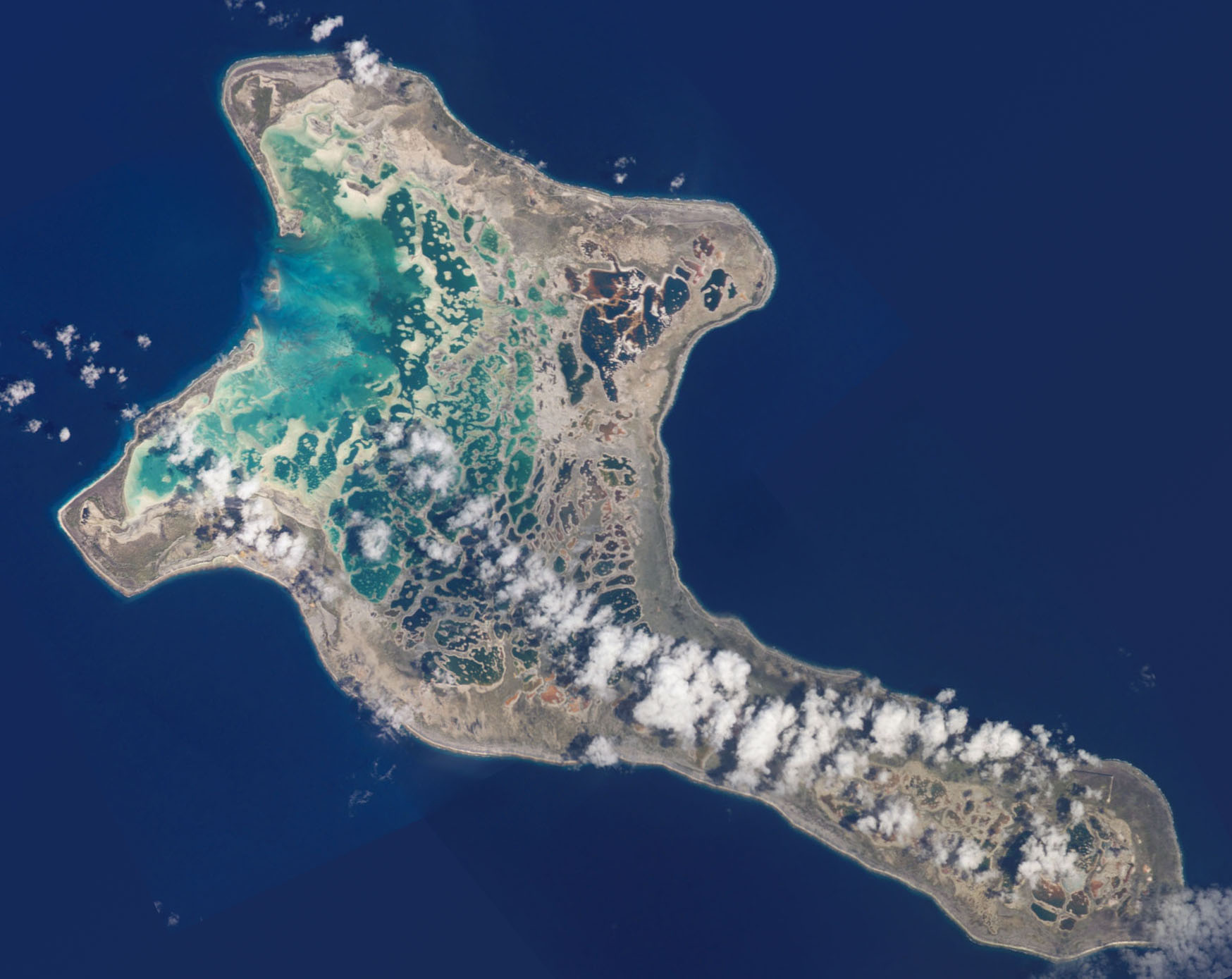
Most of this huge country is barely above the waves. Banaba reaches 87 metres, the highest point in Kiribati, but the rest of the atolls rise no more than about 8 metres, and by 1999 two small uninhabited islets had already been swallowed by the sea. Even the name hides a surprise: Kiribati is the local spelling of Gilberts, and because "ti" sounds like "s" in Gilbertese, it is pronounced "Kiribas".
Sources: Encyclopaedia Britannica: Kiribati; Rob van Gent, Utrecht University: A History of the International Date Line; The New York Times (2012); NASA: Kiritimati from the ISS, via Wikimedia Commons. Cover: Lagoon on Manra Island, Phoenix Islands, Kiribati.